Understanding bathymetric survey cost in Oman is essential for marine construction, dredging, harbour development, coastal engineering and reservoir projects.
A bathymetric survey measures underwater depths and maps seabed conditions using specialised equipment. At Gulf Testing Solutions (GTS), we provide accurate water-depth measurement and underwater terrain mapping using Multibeam Echo Sounder (MBES) systems deployed from boat-based and drone-based survey platforms.
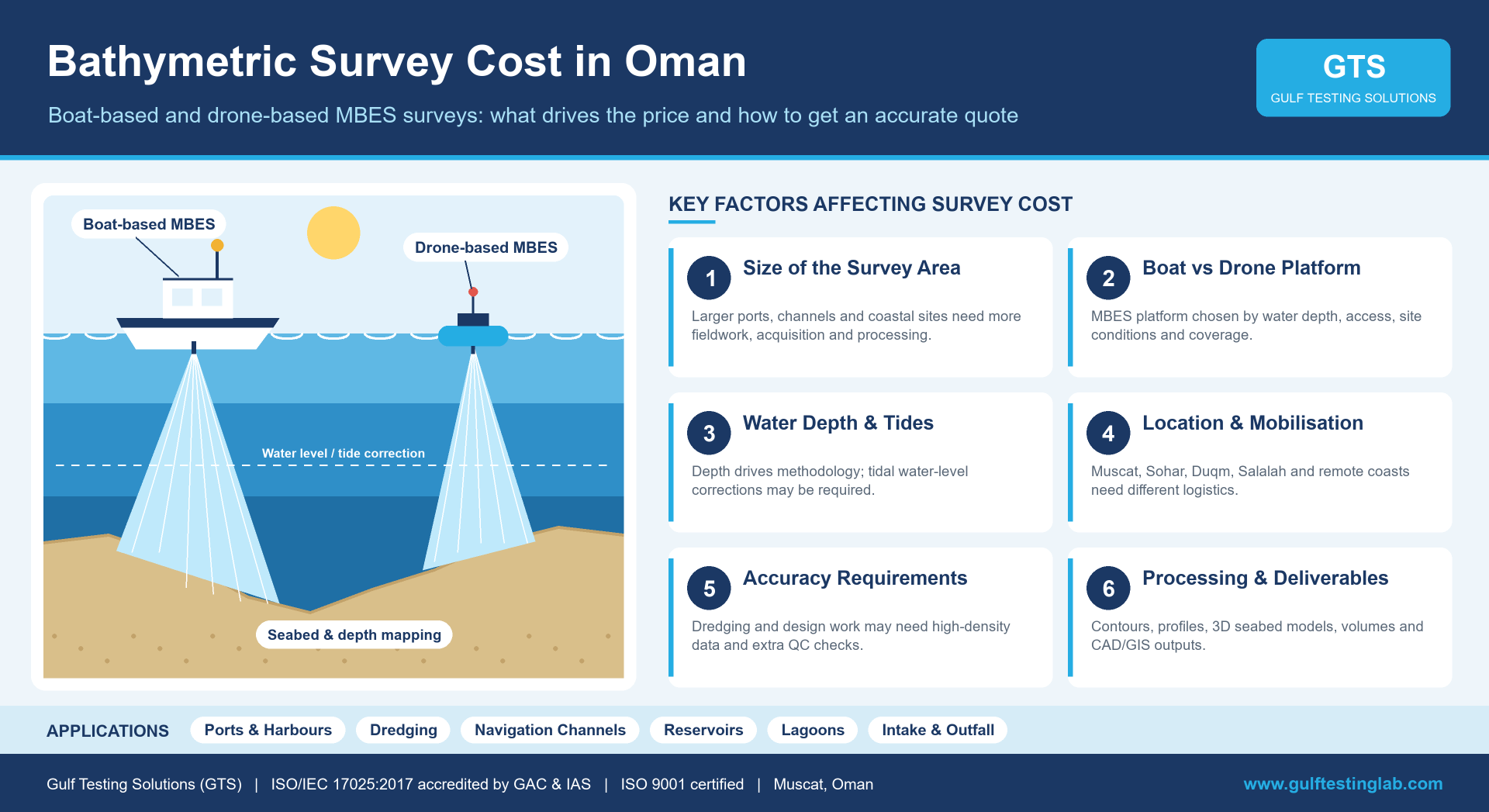
The appropriate platform is selected according to water depth, accessibility, site conditions, required coverage and project objectives.
There is no fixed price for a bathymetric survey in Oman. Costs depend on survey area, location, water depth, platform selection, mobilisation, accuracy requirements and deliverables.
What Is a Bathymetric Survey?
A bathymetric survey measures water depths and maps the shape and geometry of underwater terrain. MBES technology collects high-density depth measurements to generate detailed seabed information.
The survey can provide:
- Water-depth measurements
- Bathymetric contour maps
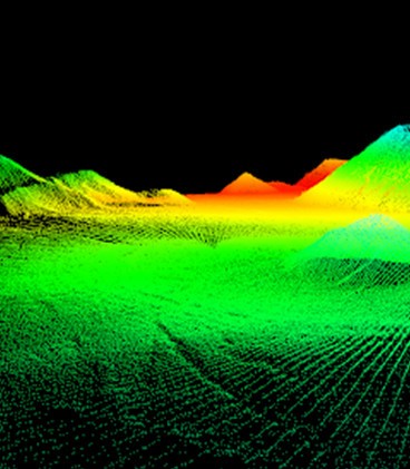
- Seabed and underwater terrain models
- Cross-sections and seabed profiles
- Dredging volume calculations
- Three-dimensional seabed surfaces
- CAD drawings and GIS-ready datasets
- Before-and-after dredging comparisons
These outputs support marine engineering, dredging, reservoir assessment and coastal infrastructure projects.
What Is the Average Bathymetric Survey Cost in Oman?
There is no standard average price because each project involves different survey conditions and technical requirements.
Survey pricing may be calculated based on:
- Daily survey rates
- Survey area and required coverage
- Boat-based or drone-based platform selection
- Platform mobilisation and operating time
- MBES equipment requirements
- Survey personnel
- Data-processing time
- Project duration
- Required deliverables
- Lump-sum project pricing
A shallow-water lagoon survey may require different resources from a large port or harbour survey. A project-specific quotation is therefore the most reliable way to determine the actual bathymetric survey cost.
Factors Affecting Bathymetric Survey Cost in Oman
1. Size of the Survey Area
Survey area is a major factor influencing cost. Smaller reservoirs, lagoons or harbour sections generally require less coverage than large ports, navigation channels or coastal developments.
As the survey area increases, fieldwork, data acquisition and processing requirements typically increase.
2. Boat-Based vs Drone-Based Bathymetric Survey
GTS uses MBES technology deployed from two survey platforms, selected according to water depth, accessibility, site conditions and project requirements.
Boat-Based Bathymetric Survey
Boat-based surveys use MBES systems integrated with precise positioning and deployed from conventional survey boats.
Best suited for:
- Ports and harbours
- Dredging projects
- Marine infrastructure
- Navigation channels
- Reservoirs
- Coastal projects
- Intake and outfall corridors
Services and deliverables:
- Multibeam Bathymetric Survey: Detailed and continuous depth acquisition across the surveyed seabed.
- Seabed and Depth Mapping: Accurate mapping of underwater terrain and seabed geometry.
- Bathymetric Contours, Profiles and Cross-Sections: Processed depth information for engineering applications.
- 3D Seabed Models and Volume Analysis: Digital surfaces supporting dredging and volume calculations.
- CAD / GIS Outputs: Structured drawings and GIS-ready bathymetric datasets.
Boat-based survey costs depend on boat mobilisation, operating requirements, survey coverage, fieldwork and processing.
Drone-Based Bathymetric Survey
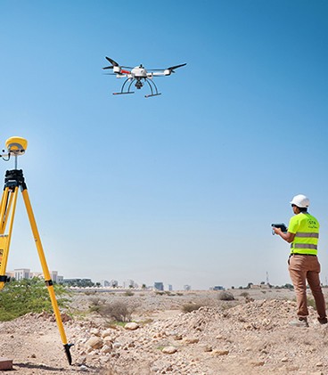
Drone-based surveys use MBES-equipped drone-based platforms for shallow, restricted and difficult-to-access water environments.
Best suited for:
- Shallow waters
- Nearshore areas
- Reservoirs
- Lagoons
- Restricted-access areas
- Coastal zones
- Intake and outfall corridors
Services and deliverables:
- Drone-Based Multibeam Bathymetry: High-density depth acquisition using drone-based platforms.
- Shallow-Water and Nearshore Mapping: Detailed mapping where conventional boat access may be limited.
- Seabed and Water-Body Mapping: Digital representation of underwater terrain and depth variations.
- Bathymetric Contours and 3D Surface Models: Processed contours, profiles, cross-sections and seabed surfaces.
- Integrated CAD / GIS Outputs: Datasets prepared for engineering and integration with adjacent land surveys.
Drone-based survey costs depend on accessibility, equipment configuration, required coverage, operating conditions and data processing.
The most suitable platform is selected based on technical requirements rather than cost alone.
3. Water Depth
Water depth influences platform selection and survey methodology.
Shallow-water environments may be suitable for drone-based surveys, while accessible ports, harbours and other marine areas may be surveyed using conventional boats. Depth conditions also affect equipment deployment, survey planning and operational requirements.
4. Project Location and Mobilisation
Survey costs vary according to project location and mobilisation requirements. Remote coastal areas may involve additional transportation and logistical arrangements.
Mobilisation may include:
- Survey boat or drone-based platform
- MBES equipment
- GNSS positioning equipment
- Data acquisition and processing systems
- Survey personnel
- Safety and supporting equipment
Projects in Muscat, Sohar, Duqm, Salalah and other locations may have different mobilisation requirements.
5. Survey Platform Requirements
The type of survey platform influences operating arrangements and project costs.
Boat-based surveys may involve:
- Survey boat mobilisation
- Fuel and operating costs
- Survey crew
- Equipment installation
- Safety and operational support
Drone-based surveys may involve:
- Drone platform mobilisation
- MBES equipment configuration
- Site access and deployment
- Survey personnel
- Operational support
The appropriate platform depends on site accessibility, water depth and the required survey coverage.
6. Accuracy Requirements
Different engineering applications require different levels of bathymetric detail and measurement accuracy.
Dredging, marine construction and detailed engineering projects may require high-density data, defined accuracy criteria and additional quality checks. Clearly specifying technical requirements helps determine an efficient survey methodology and avoid unnecessary survey costs.
7. Tide and Water-Level Measurements
Water-level variations can influence bathymetric measurements, particularly in tidal environments.
Depending on project requirements, appropriate water-level observations and corrections may be needed to obtain consistent seabed elevations. These requirements can affect fieldwork planning and data-processing effort.
8. Dredging Volume Calculations
Bathymetric surveys provide seabed surfaces that support dredging quantity assessments. Comparing surveys conducted before and after dredging can support:
- Seabed volume calculations
- Dredged quantity estimation
- Progress monitoring
- Verification of seabed levels
- Maintenance dredging planning
Detailed 3D surface modelling and volume analysis may require additional processing.
9. Additional Bathymetric Survey Requirements
Some projects require more detailed bathymetric outputs than basic depth measurements. These may include:
- High-density MBES seabed mapping
- Bathymetric contours
- Detailed profiles and cross-sections
- 3D seabed surface modelling
- Volume analysis
- GIS-ready bathymetric datasets
- Integration with adjacent land survey information
Such requirements can increase processing and deliverable preparation time.
10. Data Processing and Deliverables
MBES survey data must be processed and quality-checked before final engineering outputs are prepared. Depending on the project, deliverables may include:
- Bathymetric charts
- Contour plans
- CAD drawings
- GIS datasets
- 3D seabed models
- Profiles and cross-sections
- Volume calculations
- Digital bathymetric surfaces
- Final survey documentation
The complexity and number of deliverables influence the final quotation.
Bathymetric Survey Cost for Dredging Projects in Oman
Bathymetric surveys support dredging activities by providing seabed measurements before, during and after excavation.
- Pre-Dredging Survey
- Progress Survey
- Post-Dredging Survey
- Pre-Dredging Survey: Records existing seabed depths and provides baseline information for dredging planning and volume calculations.
- Progress Survey: Measures seabed changes during dredging and helps identify locations requiring further excavation.
- Post-Dredging Survey: Records final seabed levels and supports verification of achieved depths and dredging quantities.
The total cost depends on survey coverage, the number of survey stages, platform requirements and volume analysis.
Bathymetric Survey Applications in Oman
Bathymetric surveys support a variety of engineering and marine projects, including:
- Ports and Harbours: Depth mapping and seabed assessment for marine infrastructure.
- Dredging Works: Seabed measurements, volume analysis and progress assessment.
- Marine Infrastructure: Bathymetric information for engineering design and development.
- Navigation Channels: Detailed water-depth and seabed geometry mapping.
- Reservoirs: Underwater terrain modelling and volume assessment.
- Coastal Developments: Bathymetric mapping for coastal engineering requirements.
- Nearshore Areas: Detailed depth acquisition using suitable survey platforms.
- Lagoons and Restricted Areas: Drone-based mapping where boat access may be limited.
- Intake and Outfall Corridors: Seabed contours, profiles and bathymetric surfaces.
Platform selection depends on water depth, accessibility, coverage and project objectives.
How to Reduce Bathymetric Survey Costs
Clear project specifications help reduce unnecessary mobilisation, repeat fieldwork and additional processing.
Before requesting a quotation, provide:
- Exact project location
- Survey boundary or coordinates
- Approximate survey area
- Expected water depth
- Boat-based or drone-based platform requirements
- Required survey accuracy
- Preferred completion schedule
- Required CAD / GIS outputs
- Required models and reports
- Site accessibility and operating restrictions
This information helps GTS determine the suitable survey platform and resources.
How to Get an Accurate Bathymetric Survey Quote in Oman
An effective survey enquiry should include:
- Project Location: Muscat, Sohar, Duqm, Salalah or another location.
- Survey Area: Approximate coverage in square metres or square kilometres.
- Purpose: Dredging, engineering design, port development, reservoir mapping or coastal works.
- Water Depth: Expected minimum and maximum depths, if known.
- Survey Platform: Boat-based, drone-based or a request for technical recommendations.
- Deliverables: Bathymetric contours, profiles, 3D surfaces, CAD/GIS datasets or volume analysis.
- Timeline: Required fieldwork and deliverable completion dates.
A clearly defined scope enables more accurate project planning and quotation preparation.
Why Choose a Professional Bathymetric Survey Company in Oman?
A professional bathymetric survey provider should have suitable equipment, technical capabilities and data-processing expertise.
At Gulf Testing Solutions (GTS), our bathymetric survey services include:
- Multibeam Echo Sounder (MBES) technology
- Boat-based bathymetric survey platforms
- Drone-based bathymetric survey platforms
- Precise positioning for boat-based acquisition
- High-density depth and seabed mapping
- Bathymetric contours, profiles and cross-sections
- 3D seabed surface models and volume analysis
- CAD / GIS bathymetric deliverables
GTS selects the survey platform according to water depth, accessibility, site conditions, required coverage and project objectives.
Technical capability, appropriate methodology and final data quality should be evaluated alongside survey cost.
Get a Bathymetric Survey Cost Estimate in Oman
The most reliable way to determine bathymetric survey cost in Oman is to request a quotation based on actual site conditions and technical requirements.
At Gulf Testing Solutions (GTS), we provide boat-based and drone-based MBES bathymetric surveys for ports, harbours, dredging projects, reservoirs, coastal areas and restricted-access water environments.
Our services deliver water-depth measurements, seabed mapping, bathymetric contours, 3D surface models, volume analysis and CAD/GIS outputs according to project requirements.
Need a Bathymetric Survey in Oman?
Contact GTS with your project location, survey area, water depth and required deliverables to receive a customised bathymetric survey quotation. Visit www.gulftestinglab.com to get in touch.
Frequently Asked Questions
How much does a bathymetric survey cost in Oman?
Costs depend on survey area, location, water depth, selected platform, mobilisation, accuracy requirements, processing and deliverables. A site-specific quotation is recommended.
What affects bathymetric survey cost in Oman?
Major factors include survey size, boat-based or drone-based platform selection, accessibility, water depth, mobilisation, project duration and deliverables.
Is a drone-based bathymetric survey cheaper than a boat-based survey?
Not necessarily. Drone-based surveys may offer advantages in suitable shallow-water or restricted-access areas, but actual costs depend on project and site requirements.
How long does a bathymetric survey take?
Duration depends on survey area, water depth, site conditions, required coverage, survey platform and data-processing requirements.
What equipment is used for bathymetric surveys?
GTS uses Multibeam Echo Sounder (MBES) systems deployed from boat-based and drone-based survey platforms, with suitable positioning and supporting survey equipment.
Can bathymetric surveys calculate dredging volumes?
Yes. Comparing bathymetric seabed surfaces can support dredging volume calculations and assessment of seabed changes.
Where are bathymetric surveys conducted in Oman?
Bathymetric surveys can support projects across Oman, including Muscat, Sohar, Duqm, Salalah, ports, harbours, reservoirs and coastal areas, subject to site conditions.
How do I request a bathymetric survey quotation?
Provide the project location, survey boundary, water depth, site accessibility, required accuracy, deliverables and timeline for a customised quotation.