Every successful construction project begins with a strong foundation—but before a foundation can be designed, engineers must first understand the ground beneath it. This is where soil investigations and geotechnical surveys become essential.
Whether you’re constructing a residential villa in Muscat, an industrial facility in Sohar, or infrastructure in Duqm, understanding the subsurface conditions helps prevent costly structural problems and ensures long-term safety.
In this guide, we’ll explain what soil investigations and geotechnical surveys are, why they matter, and why they are especially important for construction projects across Oman.
What Is a Soil Investigation?
Think of a soil investigation as a complete health check-up for the ground.
Just as a doctor performs tests to understand a patient’s health, geotechnical engineers examine the soil beneath a construction site to determine whether it can safely support a structure.
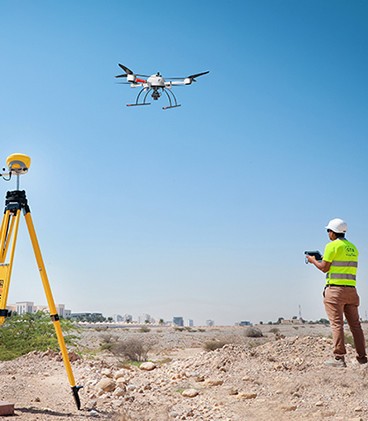
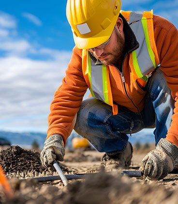
The investigation typically involves drilling boreholes at different locations and depths to collect soil samples. Since soil conditions vary significantly from one location to another—and even within the same site—this process provides valuable information about the different underground layers.
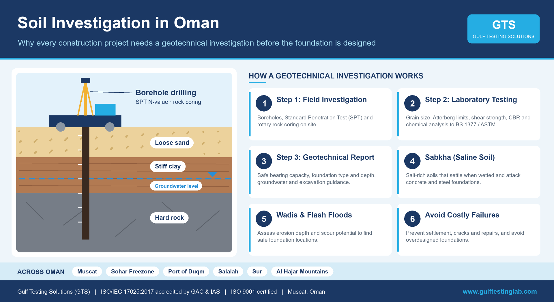
For example, a single construction site may contain:
- Loose sand near the surface
- Stiff clay at intermediate depths
- Hard rock below
Each material behaves differently under structural loads:
- Loose sand can settle quickly under load.
- Expansive clays swell when wet and shrink when dry, potentially causing foundation movement.
- Rock provides excellent support but can increase excavation costs.
The collected samples are tested in a laboratory to determine important engineering properties, including the soil’s bearing capacity, allowing engineers to design safe and cost-effective foundations.
What Is a Geotechnical Survey?
While a soil investigation focuses primarily on soil characteristics, a geotechnical survey provides a broader understanding of the entire site.
It evaluates:
- Geological conditions
- Groundwater levels
- Soil and rock formations
- Potential subsurface hazards
- Overall site stability
One of the most critical aspects of a geotechnical survey is groundwater assessment. High groundwater levels can:
- Flood excavation areas
- Reduce soil strength
- Increase construction difficulties
- Increase liquefaction risk in loose, saturated sands during earthquakes
Geotechnical surveys also identify regional geological hazards specific to Oman.
Mountainous Areas
In regions such as the Al Hajar Mountains, surveys assess:
- Rockfall risks
- Landslide potential
- Underground cavities
- Weak rock formations
Coastal Regions
In coastal cities like Salalah and Sur, engineers evaluate:
- Loose marine sediments
- High groundwater levels
- Corrosive saltwater conditions that may affect concrete and steel foundations
Why Oman Requires Specialized Geotechnical Services
Oman’s diverse geography presents unique engineering challenges that require detailed geotechnical investigations before construction begins.
1. Sabkha (Saline Soil) Conditions
Many coastal and desert regions contain Sabkha soils, which appear stable but can become highly unstable when exposed to water.
As groundwater rises or rainfall occurs, the salt dissolves, causing significant ground settlement. Additionally, high salt concentrations accelerate corrosion in reinforced concrete and steel foundations.
A professional soil investigation helps detect Sabkha conditions early and allows engineers to recommend suitable foundation designs and protective measures.
2. Rapid Industrial and Infrastructure Development
Oman continues to invest heavily in major infrastructure and industrial developments, including:
- Port of Duqm
- Sohar Freezone
- Logistics hubs
- Manufacturing facilities
- Renewable energy projects
Large structures such as storage tanks, industrial plants, bridges, and wind turbines place enormous loads on the ground. Geotechnical investigations ensure these structures remain stable throughout their service life.
3. Mountainous Terrain and Wadis
Many development projects are located near wadis or mountainous terrain.
Although wadis remain dry for much of the year, heavy rainfall can generate powerful flash floods capable of eroding soil and undermining foundations.
A geotechnical survey helps engineers understand:
- Flood erosion depth
- Soil stability
- Scouring potential
- Safe foundation locations
This information is essential for designing durable roads, bridges, and other infrastructure.
How a Geotechnical Investigation Works
A typical geotechnical investigation follows three major stages:
- Field Investigation
- Laboratory Testing
- Engineering Analysis & Reporting
Step 1: Field Investigation
The process begins with fieldwork using specialized drilling equipment. Engineers drill boreholes to depths determined by the size and loading requirements of the proposed structure.
During drilling, they often perform the Standard Penetration Test (SPT). The SPT measures soil strength by recording how many hammer blows are required to drive a sampling tube into the ground.
In the test, a 63.5 kg hammer is dropped from 760 mm, and the number of blows needed to drive the sampler the final 300 mm is recorded as the SPT N-value (ASTM D1586 / BS EN ISO 22476-3). Higher blow counts generally indicate stronger soil, while lower counts suggest softer ground.
Where rock is encountered, rotary core drilling recovers rock cores so engineers can assess rock quality, including core recovery and Rock Quality Designation (RQD).
Step 2: Laboratory Testing
Collected samples are carefully preserved and transported to an accredited laboratory for testing. Tests are carried out to recognized standards such as BS 1377 and ASTM. Typical laboratory tests include:
- Grain Size Analysis – determines the proportions of sand, silt, and clay.
- Moisture Content – measures the amount of natural water present within the soil.
- Shear Strength Testing – evaluates the soil’s resistance to sliding and structural failure.
- Chemical Analysis – checks for harmful chemicals such as sulphates and chlorides, along with pH, that may damage concrete and reinforcement steel.
- Atterberg Limits – measure the plasticity of fine-grained soils, which helps identify clays prone to swelling and shrinkage.
- Consolidation and Collapse Potential – show how much a soil will compress under load, and whether dry desert soils may collapse suddenly when wetted, a common concern in Oman.
- California Bearing Ratio (CBR) – evaluates the strength of subgrade soils for roads, pavements and hard standing areas.
- Rock Strength Testing – uniaxial compressive strength (UCS) and point load tests determine the strength of rock cores for foundation design.
Step 3: Engineering Analysis and Geotechnical Report
Once testing is complete, geotechnical engineers analyze all collected data and prepare a comprehensive report. This report typically includes:
- Recommended foundation depth
- Suitable foundation type
- Safe bearing capacity
- Groundwater observations
- Soil improvement recommendations
- Construction precautions
- Excavation guidelines
Structural engineers rely on this report when designing safe and economical foundations.
The Cost of Skipping a Soil Investigation
Some developers view geotechnical investigations as an additional project expense. In reality, they are one of the most valuable investments in any construction project.
Without accurate soil data, foundation designs are based on assumptions rather than scientific evidence. This can result in:
- Uneven settlement
- Structural cracks
- Misaligned doors and windows
- Damaged pipelines
- Expensive repairs
- Structural instability
Correcting foundation failures after construction can cost many times more than conducting a proper soil investigation before work begins.
On the other hand, a detailed investigation can also reduce construction costs by preventing unnecessary overdesign of foundations.
Building a Safer Future for Oman
As Oman continues expanding its cities, industries, transportation networks, and tourism infrastructure, the importance of geotechnical engineering continues to grow.
Soil investigations and geotechnical surveys provide the scientific information needed to design safe, durable, and cost-effective structures. From residential developments and commercial buildings to ports, highways, and industrial facilities, these investigations help ensure every project is built on a foundation of confidence.
Investing in professional geotechnical investigation services is not simply a project formality—it is a commitment to safety, sustainability, and long-term performance.
For every successful construction project in Oman, the journey begins beneath the surface.
Geotechnical Investigation with GTS
Gulf Testing Solutions (GTS) provides geotechnical investigation services across Oman, from borehole drilling and in-situ testing to laboratory testing and engineering reports. GTS is accredited to ISO/IEC 17025:2017 by GAC and IAS and certified to ISO 9001.
To plan a soil investigation for your project, visit www.gulftestinglab.com or contact our Civil and Geotechnical team.
Frequently Asked Questions
What is the difference between a soil investigation and a geotechnical survey?
A soil investigation focuses on the properties of the soil beneath a site. A geotechnical survey is broader and also covers geology, rock, groundwater and site hazards. In practice, most projects need both, delivered together as a geotechnical investigation.
How many boreholes does my project need?
It depends on the size of the site, the structural loads and how variable the ground is. A geotechnical engineer sets the number and depth of boreholes, typically following BS EN 1997-2 (Eurocode 7) guidance.
What is sabkha and why does it matter?
Sabkha is a salt-rich soil found in coastal and inland flats. It can lose strength and settle when wetted, and its salts attack concrete and steel. It must be identified early so that suitable foundations and protection can be specified.